Welcome to my day walks

The dates listing these walks are the dates I uploaded the stories. They are in no particular order, and it doesn't matter because you were directed here from elsewhere!! I hope you enjoy the journey..


The Lost Valley

Found it – The Lost Valley


19th September 2009
Map: Landranger 41
Weather: Initially rain, followed by a small sunny spot, clearing to rain at the end of the walk.

From the car park below Am Bodach, drop down into the valley and cross the River Coe. Proceed steeply up the valley of Coire Gabhail, to happen upon the Lost Valley or Hidden Valley. Continue to the head of the valley up to the col at Bealach Dearg. Return by the same route: 8 miles by Satmap Active 10 gps

I had been looking forward to this return visit to Scotland ever since I walked the West Highland Way in 2008. I loved the scenery, the peace and the people on that walk, and on day 7 of the WHW, I had a good look up at the Aonach Eagach and vowed to return. So after 2 weeks work in Denmark, I got back home and packed a weekend bag for the drive up to Bonny Scotland. I wish I could have said the same for the weather forecast, and my original intention of walking the ridge on Saturday was thwarted. But I had a good journey up on Friday and had the pleasure of bumping into Mr Jingle Jangle Jewellery - Sir Jimmy Saville. He was good fun and is standing the test of time – he probably has the best house in Glencoe as well – it’s the one with the white rose of Yorkshire flying proudly alongside the Saltire.

Photobucket
The Ballachullish horseshoe, but not today

Photobucket
Two of the three sisters

The tops were ominously cloudy for tomorrow and Mike (Peakbagger of the walking forum) decided that he wasn’t going walking on the Saturday as his knee was giving himself some gyp, so he drove to Mallaig instead. We decided that the Ballachullish horseshoe would be a decent stomp for the Saturday as the weather forecast said rain and there was no way I was going up the Aonach Eagach in the wet. Saturday dawned misty and we couldn’t see the top of the Ballachullish horseshoe, which meant another change of plan and we decided to walk up to the Lost Valley.

Photobucket
The River Coe

Photobucket
Steeply up through some birch wood

After a leisurely start to the day, we reached the car park at the base of Am Bodach in a veritable Scotch mist. There were lots of tourists pulling up into the car park and taking a few snaps before moving on, and several coaches of steamed up windows. So we assumed we would be getting rather wet and donned full waterproofs and some more – gloves included. It was absolutely teeming down, but the car park was a good view point for looking at The Three Sisters – they must be triplets because they looked very similar – big foreheads high in the air – and all of them very imposing, as is Glencoe in general. From the car park we dropped down into the Glen walking along a good path that was rocky in places with a red/purple hue looking like weathered bricks. It was easy walking down to the river and there we came across a deep cut gorge that follows along the Great Glen faultline. The water was flowing so clear, a slightly turquoise colour against the deep red berries of the rowan trees, with little golden discs of leaves floating along – very hypnotic to stare at from the wooden bridge. The steps down to the bridge are steep and have wide spaced steps – no good for short legs. After the bridge the ground rises across and up a rocky section before reaching a boggy patch. A wooden path has been laid across the worst of the boggy patch.

Photobucket
Gloomy ahead up in the valley

Photobucket
Just above these small falls we crossed the river

Photobucket
The small rock rake – not too bad even in the wet


Photobucket
And all of a sudden there it is – found it

High above to our right was the middle sister – Gearr Aonach – with its crags looking very foreboding. The walk continued along a narrow path through a sparsely wooded valley, with the river below us to the left, cut deeply into the hillside in places. There were also a few clear pools with the occasional waterfall, all very peaceful, and very, very wet. It was a struggle to keep the camera lens clear today, and my lens wiper got ever damper as the walk progressed. There was lots to look at on the way both geologically and geomorphologic-ally, as this is an area of igneous intrusive rocks such as granites and rhyollites. There are also intrusive dykes – not the type who interrupt conversation in the pub – so we spent some time looking at the melange of rocks as we walked along.

Photobucket
A large boulder bedded in river gravel

Photobucket
A brief moment of warmth looking back down the valley

A little further up it was time to cross over the burn by some boulders – ok as long as it isn’t in spate, and then up a small rock ledge, which is ok and doesn’t present much of a problem - just take your time at this point. The path stayed up the left side of the burn and continued up some rocky steps onto another path that leads up to the lost valley. We carried on in the relentless rain to reach a brow of the hill and as the rain eased there was the lost valley laid out before us. What a delight to see – it resembled a giant Japanese garden from a certain aspect, with massive boulders in a rock scree.

Photobucket
A great amphitheatre ahead, with some glimpse of sunlight

Photobucket
At the end of the flat area – you can see the line of erosion continued across the valley

It must have been part of a terminal moraine before it got washed away, with the valley behind filling up to form the flattish level seen today. All it needs is someone with a giant rake – although the burn tries its best. There wasn’t any standing water here today, it was flowing beneath the river bed, and it was dry enough to wander around the river bed. It was a lovely spot for a break and refreshments, but still cold even though the rain had stopped and the sun came out. There were lots of nooks and crannies to explore, but we decided to venture further up the valley now that the rain had stopped.

Photobucket
The deep gorge down to the left – frogs to the right

Photobucket
Higher up the valley, looking back you can see the rock sculpting

This is not your typical U-shaped valley seen in much of the area, although you can see some curvature / rock sculpting further up the valley on the left hand side. There is also a very distinct straight line up and down this valley, and this is continued across Glencoe to A Chailleach (you can see this on the OS map). I think this must be a line of weakness associated with the Dyke swarms or a faultline, but I couldn’t find one on my geology map at home. Many of the rocks up here showed signs of heat alteration, with great banded rhyollites and tuffs, almost jewellery like in quality. Mind you they weren’t that good or Jimmy ‘now then’ Saville would have had some on a chain – jingle jangle jewellery.

Photobucket
This was as close as I wanted – too much water around

Photobucket
Looking directly down the valley from the steep slope up to the beallach

We found a great piece of granite but it was too heavy to hump around for several hours. We wandered further up the flat hidden valley to start the long walk up to the head of the valley at Beallach Dearg. The burn reappears here deeply incised in the ground, with an almost vertical side – very fault like. The path ascends at a gentle gradient at first, away from the burn for a while, with occasional glimpses of Am Bodach and the Aonach Eagach ridge behind us. Unfortunately most of the tops were obscured by misty cloud including Bidean nam Bian and Stob Coire Sgreamhach – goodness knows what the correct pronunciation is – I’m a language mangler at the best of times. We came across an alpinist frog leaping up the slopes, presumably on holiday – what a strange sight, but there are plenty of side streams that tumble down the valley sides.

Photobucket
The best way up was to the right of the scree

Photobucket
Bidean nam Bian cloud free – but not for long

Up towards the higher ground at the head of the valley there are some lovely waterfalls that tumble into the deep cut gorge, with the walls opposite coppery looking from peat staining. The corrie up here wasn’t your typical corrie either but the surrounding hills provided a great amphitheatre. Beyond the waterfalls the heart beat rises as does the path, and it becomes a mixture of bedrock, loose scree, with occasional bits of normal path. You can see the red scree at the head of the valley from some way back, but the better route for us was to stay to the right hand side, where there is plenty of hands on walking. The red scree is quite loose and definitely harder to walk up than on solid bedrock. Towards the very top there is a small runnel for the last 30ft or so, but again this is not so bad. Some care had to be taken not to slip, but we stayed up the right side and pulled our way to the top.

Photobucket
The view from the beallach looking south – Glen Etive

Photobucket
Stob Coire Sgreamhach

Then you’re up there and the views open up to the hills further south, and so does the wind – it was on with the hat and gloves, more snacks and a good toot around. The Beallach is over 3000ft but that doesn’t count as a munro – Glen Etive is to the south, with Bidean nam Bian up to the right at 3724ft and Stob Coire Sgreamhach up to the left at 3515ft. So the choice was going up to the right or up to the left – 30 minutes one way, 50 minutes the other (up and down). But, it was already 4pm and there was a 2 hr walk down from the Beallach. The weather finally made up our minds, with the wind and rain whipping in and it was bl*^dy cold. As I’m not a munro bagger and I fancied a pint in the Claichach Inn, I thought stuff it were off. We were wet enough and I didn’t want all my gear to be sopping wet for the main event tomorrow, so after a quick trot a little way up Stob Coire Sgreamhach for a photo, we made our way down the rake carefully and picked our way down the path we had come up on.

Photobucket
That’s Sir Jimmy’s house

Photobucket
A last look up – it’s nearly stopped raining now

Photobucket
For sisters they look a bit sinister, big brother Bidean nam Bian looking over them

We tried the scree but to be honest it felt better over to the side, and it really started to persist it down – but I stayed positive and thought more rain today, less tomorrow. On our way down, the cloud cleared now and then to reveal Aonach Eagach, and it looked pretty formidable from up here. The mental process took over and I began to wonder about how difficult it will be. Gradually we made our way down the valley to return to the car with the Three Sisters looking down on us from on high. I was glad to get back to the car park and hoped that my gear would be dry by the morning – it was. So next stop was the Clachaig Inn, an excellent venue where I had several pints and some gulps ahead of tomorrow’s adventure. Altogether it was a great day to be out in the rain – but I wasn’t singing until later.
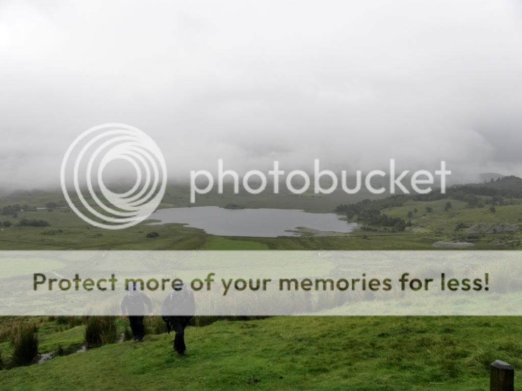
The Nantlle Ridge / Cwm Ciprwtht

The Nantlle Ridge and Cwm Ciprwth Copper works


13th August 2009

Map: Landranger 115

Weather: Initially rain, followed by more rain, clearing to rain at the end of the walk.


From Rhydd Ddu up to Y Garn, taking in all of the Nantlle ridge 7 summits, dropping down to Cwm Ciprwth. Walk up Cwm Pennant to the head of the valley and return to Rhydd Ddu through the forest: 15.3 miles by Satmap Active 10 gps with a diversion


Three of us had been down to the Nantlle Ridge a couple of months ago and had been frustrated by some inclement weather. So we set a date and returned to Rhydd Ddu and were frustrated by some inclement weather. We pretty well knew our fate the day before as the forecast was not so good. The last time we were up on the ridge, we got blown off by some severe turbulent wind – not me for a change but a meteorological phenomenon. The forecast was mixed but I think we all knew we were in for a wet start.

Photobucket

Head down and grind uphill


Photobucket

I’m not last for a change – getting wetter


So self, Mike, Max, Mark and Robbo all kitted up in full gear ready for the off. We kept the thought of a chance of clear weather later – well we can all dream. We set off from the roadside above Rhydd Ddu at a good clip and Mountain Mike (fit from his exertions in the Scottish Hills) soon led the way up to the steep slopes up Y Garn. I usually take about 150 snaps when out for a good long walk, on the basis that if 10% turn out OK, then I would have a good record of the day. But today I ended up with very few good pictures and a soggy lens cleaner and a misty, damp camera. Mike was first up to the wall near the summit, with the rest of us gradually converging up the slopes – us seniors taking our time. The views at the first summit were nil, just a fine all invading misty drizzle that insinuates itself into every crevasse of your waterproofs. But at least the wind wasn’t blowing like last time and there was a small chance of a clear spell.


Photobucket

Three ghostly figures appear from the first summit


It is fairly flat along to the second summit, but it soon became apparent that the rocks and boulders were treacherously slippery and care had to be taken walking up to the second peak of Mynedd Drws-y-coed. Mike and I stopped down on the col and things looked a lot calmer than they were the last time. We couldn’t see a thing around us due to the low cloud, and hardly anything of the near 500ft vertical drop over Clogwyn Marchand. We waited around a bit for the other three who had been posing for pictures against a pinnacle – above the 500ft drop. It looked safe enough in the mist! This time around we crossed the col without problems and made our way up to the third summit Trum y Ddysgl – we still couldn’t see much and at least the rain was consistent – consistently wet. Up on top I caused much mirth for the Welsh contingent by pronouncing Moel Hebog as ‘Moley Bog’, but I knew what I meant. A feature of the first 3 summits was the up and down of 200 to 300ft, not too fatiguing but enough to work up a sweat. We plodded on in thick mist along to the 4th summit of Myndd Tal-y-mignedd with a Jubilee Obelisk on top. This was built to celebrate Jubilee Ice Lollipops or it could have been Queen Victoria?


Photobucket

The obelisk for the Jubilee – no way up today


Photobucket

Robbo offers a helping hand


The Obelisk has a geocache on top apparently and Mark had a go at climbing up, but it was far too treacherous. Only a madman would attempt this – so he did – but the geocache lived to fight another day and so did Mark. We all took some fuel on board – soggy butties are delicious, and we admired the views – never seen so much lovely mist since the last time here. Then the fun started down off Myndd Tal-y-mignedd to Bwlch Dros-bern was simple enough, but the route up to the 5th summit involved a small scramble or a short walk around to the side of the ridge. Mad Max asked what we wanted, so we all grunted scramble - slippery rock or not.


Photobucket

Robbo before his trip – watching out for the failed scrambler


Photobucket

Mad Max pondering his route to the top


Photobucket

Mike in waiting pose – he does this a lot


Photobucket

A brief moment of clarity – looking back to the obelisk


One out of the five of us didn’t make it due to the fact he had nobody to give him a shove up and over. A & B got a good shove up with the boot, onto a small quartzite, knobbly hold – the rest of the rock was very slippery with the fine mist. C got up quite easily because of his longer arms. D got a shove from E, and E had to go all the way down again to look for a different route up - a bit frustrating for him really.


Photobucket

There was some beauty around despite the rain


Photobucket

Almost up to the lunch spot


Photobucket

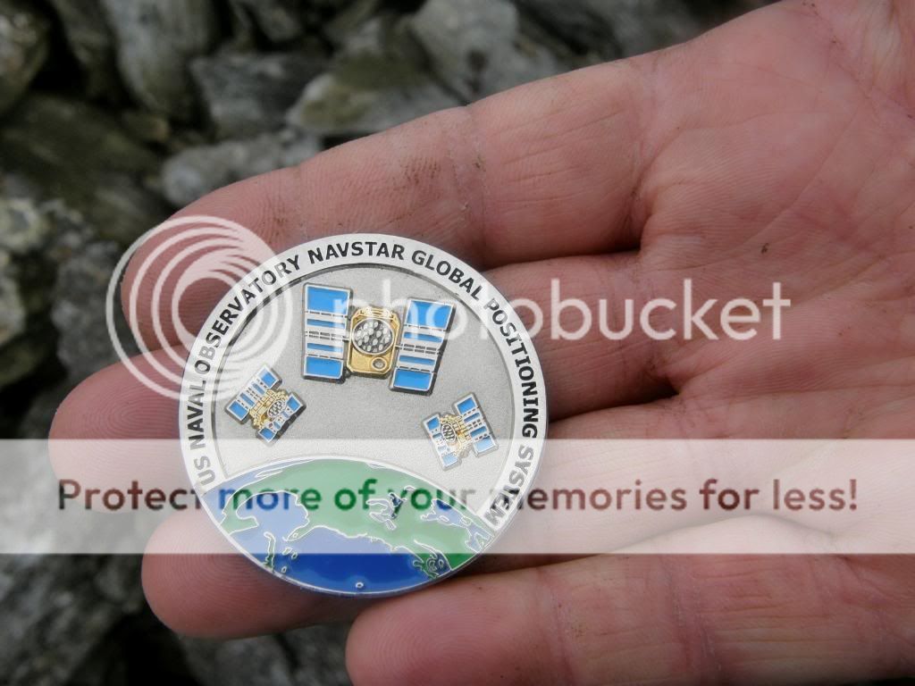
The Geocache prize coin


Photobucket

Five go walking – Mark, Mike, Robbo, Self and Max


Apart from the rain, all was well with our world as we topped out towards the 5th peak of the 7 summits and then calamity struck. Robbo went hard over on his ankle and was in considerable pain for a little while. But being a real trooper he walked it off as we made our way along Craig cwm Silyn towards Garnedd Goch. Then to add insult to injury the mist momentarily cleared to give us a brief glimpse of the valleys below, ad behind us the Obelisk appeared for a few seconds. We snapped away thinking we were in for a real treat with the skies clearing, but it was a cruel hoax and the misty curtains drew once more, but at least it stopped raining long enough for us to get some lunch. We made our way up to Garnedd Goch and had a sit down and relax. Max and Robbo scrabbled around for the geocache and explained the intricacies of chasing around the countryside for small Tupperware boxes. Luckily for us this one had a coin in – nice and shiny – and Robbo will be transporting it to another part of the globe somewhere. We posed for a quick picture together by the summit shelter, before setting off once more towards the last part of the Nantlle Ridge – Mynedd Craig Goch. Once more the rain started to coat us with an all consuming mist –wet, wet, wet, as we dropped down 500ft to go up again, but all on a gentle incline. It was easy walking for a while, but obviously not for Robbo, as the strain told on the uneven ground.


Photobucket

The valley down to Cwm Ciprwth gathers us up


Photobucket

And this was as clear as it got


Photobucket

One of the falls close to the mine works


By this time I didn’t take many pictures as my camera was rather soggy, and the lens a bit moist. Once we had bagged the last summit the biggest problem in dropping off the hill was the lack of any discernable paths, not even any sheep tracks. It was a mix of heather, boulders and boggy moss and reeds – the moss mounds here were huge but wet. Myself, Robbo and Mike had full waterproofs on, but Mark and Max were now just wearing shorts and had very wet feet. Following Max along it looked like the tide was coming in and out with each step as there was more water inside his boots than outside.


Photobucket

Further down the valley the works come into view


Photobucket

One of the old ore buckets?


Photobucket

This is totally unexpected in the middle of nowhere


Photobucket

It was starting to really persist it down


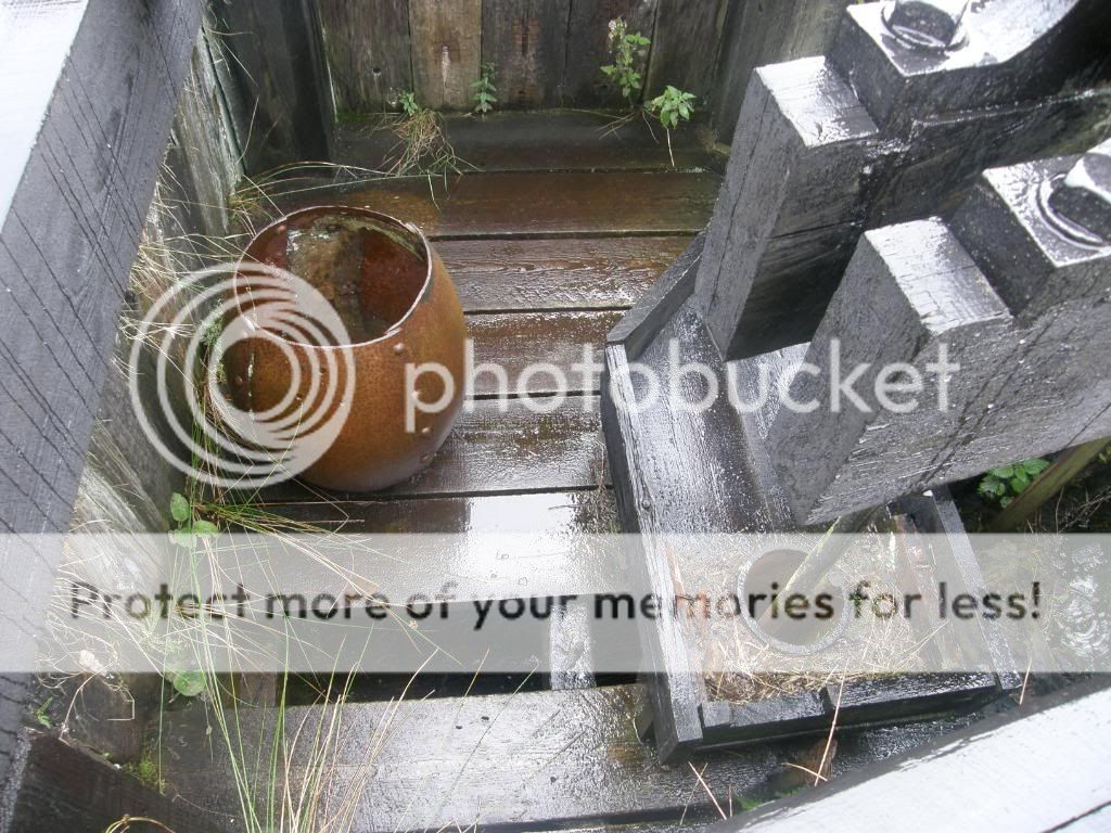
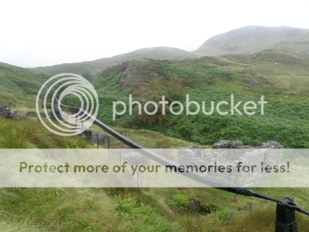
Max, Mark and Mike led the way down into Cwm Ciprwth where the delight of the day awaited us. Robbo really struggled now with the lack of path and not being sure of his footfall, and it looked painful every step of the way. Of course the persistent rain didn’t help, but at least we had some sort of view now we had dropped down below the cloud base. The valley gathered us in as we dropped further down the hillside, we passed by a few falls and there below us were the remains of the Cwm Ciprwth Copper mine – a 25ft waterwheel with some connecting wooden struts. These stand alongside a few ruined buildings – some more information can be seen here – www.penmorfa.com/cwmciprwth / . It was great to see this in the middle of nowhere and is well worth a visit. We had a good mooch around even though it was very wet and the ground very boggy.


Photobucket

One of the long wooden links


Photobucket

The big wheel – better than the amusement parks


Photobucket

A mini chandelier – the fine mist settled on the seed heads


Our walk began to fall to pieces about now, as I crossed the river by a plank to look for another path and unfortunately didn’t spot the yellow marker posts a little further on. So we walked down the other side of the river, following a quad bike track – which was handy as we were walking across very soggy ground at the base of the hillside. But we reached a bit of an impasse at the fast running stream of Ceunant Ciprwth, and the old crossing point – a plank on some concrete – was missing. So Max and Mark just waded across the stream as they couldn’t get any wetter anyway - the rest of us had dry feet. So we wandered a little further downstream, but the valley got steeper, so Mike went looking for a place to cross. So we waited, and waited, and eventually decided that Mike was a jumper downstream. So we had one more look to find a crossing and had no choice but to return upstream to the mine workings and walk the plank – there was no way Robbo could jump with his ankle knackered. So it was a splodge back uphill, more strain for Robbo and really the consequence of all of this was quite sever at the end of a very long day.


Photobucket

The first picture for a while – still wet – that’s Moel Hebog in the distance


Back at the mines we crossed over the stream and ducked under a hole in the drystone wall – well bollix I thought – there was a path that not only went down but up as well – I took a mental note for next time up! We followed the yellow markers down through some old sheepfolds, passed by an old mineshaft, and beyond a spoil heap to walk steeply down through woodland to reach the valley floor. Unbeknown to us Max had negotiated a lift for Robbo, but Robbo was feeling a little peeved at his ankle and didn’t want to stop, and disappeared up the lane. So the decision was made for us to all continue on towards the end of the walk. Cwm Pennant must be a magnificent valley when the sun is shining, surrounded by majestic hills on both sides of the valley, with the famous Moley Bog prominent – but not today as it kept it’s secrets in a cloudy cloak. Further up the valley the farmer was charging £1 for car parking – no doubt it must be busy sometimes at the weekends. There are many remnants of better times in the valley – a dilapidated farmhouse and old mine workings - some EEC money is being put to use mending fencing though. It was still a pleasure to view all around despite the rain, and as we left the farm track the ground rose steeply once more as we made our way up the valley side to the old mine workings along Cwm Trwsgl.


Photobucket

Nearly down out of the cloud


Photobucket

Rhydd Ddu and the pub in sight


There are lots of old buildings to look around here as well, but we didn’t hang about as we had explored them before and the day was long already. Robbo plodded on manfully up to Bwlch-y-Ddwy-elor and on through the plantation forest, getting closer to the end. Soon enough we got out of the trees and wouldn’t you know it the cloud had lifted, with some patches of blue to the South. Y Gran was still covered in an angry looking cloud cap. But the day wasn’t yet at an end, and as we approached Cwm Marchnad the fast running water left no option but to dip a boot in. But with careful foot placement my feet stayed dry. But behind us was calamity once more as Robbo went over on the same ankle again – ouch ouch ouch. We all felt for him, and he had no option but to hobble the last ¾ mile back to the cars, and that included sinking into a boggy patch as well. We finally reached the car after 10 ½ hours of slog, with blue skies shining above Y Garn and the village pub lit up by a shaft of sunlight.


Photobucket

Harrumph – no comment


Photobucket

Y Garn still playing hard to get


The smart ones amongst us had bought a change of clothes – my feet were dry, but my pants haven’t been so wet for about 50 years or so. This was a great walk in good company and it was nice to meet Mark and Max for the first time. We sat in the pub for a quick pint and all agreed we’d have to return in the sunshine sometime to do this magnificent route – strenuous but worth it. Unfortunately for Robbo his ankle swelled up like a balloon as he had strained his tendons – so he had to have feet up for a little while – but he’s ready again now – bring on the sun, and maybe its 3rd time lucky for a look at the Nantlle Ridge.

About Me

My photo
Enjoying life. Work in Norway, walk anywhere.

Followers