Hanging around Helvellyn, via Striding Edge
Date: 12th July 2008.
Map: Landranger 90
Weather: Overcast at first, with a low cloud base lifting above the summit.
A Helvellyn round, up to Birkhouse Moor and on to Striding Edge. Up to the summit of Helvellyn, on to Whiteside and Raise, returning to Glenridding via Greenside valley: 10 miles on the map, but felt like much less for a change.

Copyright OS-Click on map to enlarge, then hit the back button to return to blog
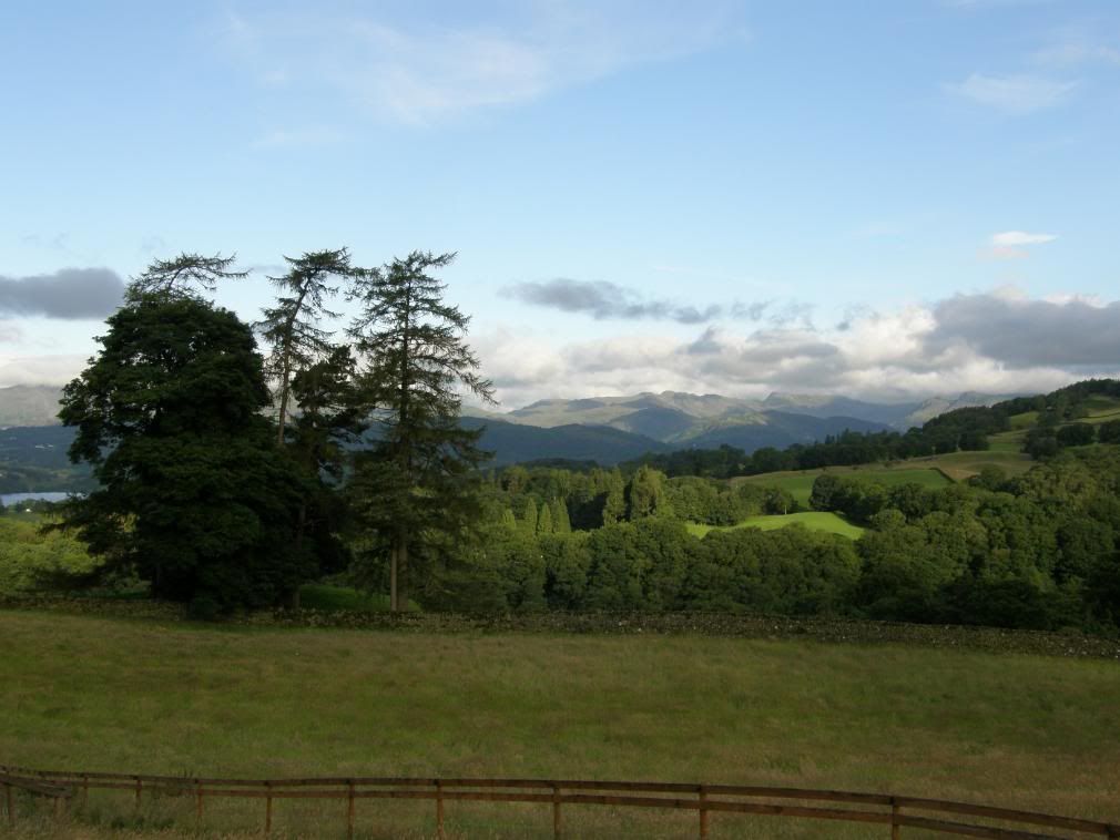
A typical British summer was developing, with high pressure over Europe and a constant stream of depressions flowing across the UK. Good for the grass and garden but not much else. I usually play golf on a Saturday but the chance of walking up Striding Edge was too good to miss. I walked today with Stuart, who had been putting off this walk because of wet weather for many weeks. But we decided to take a chance and with my lucky T-shirt on, I knew we wouldn’t be disappointed. As we approached Troutbeck on a minor road the views ahead were superb at 7 am, but the tops of the hills were obscured with a low cloud base.
Would the clouds lift later?
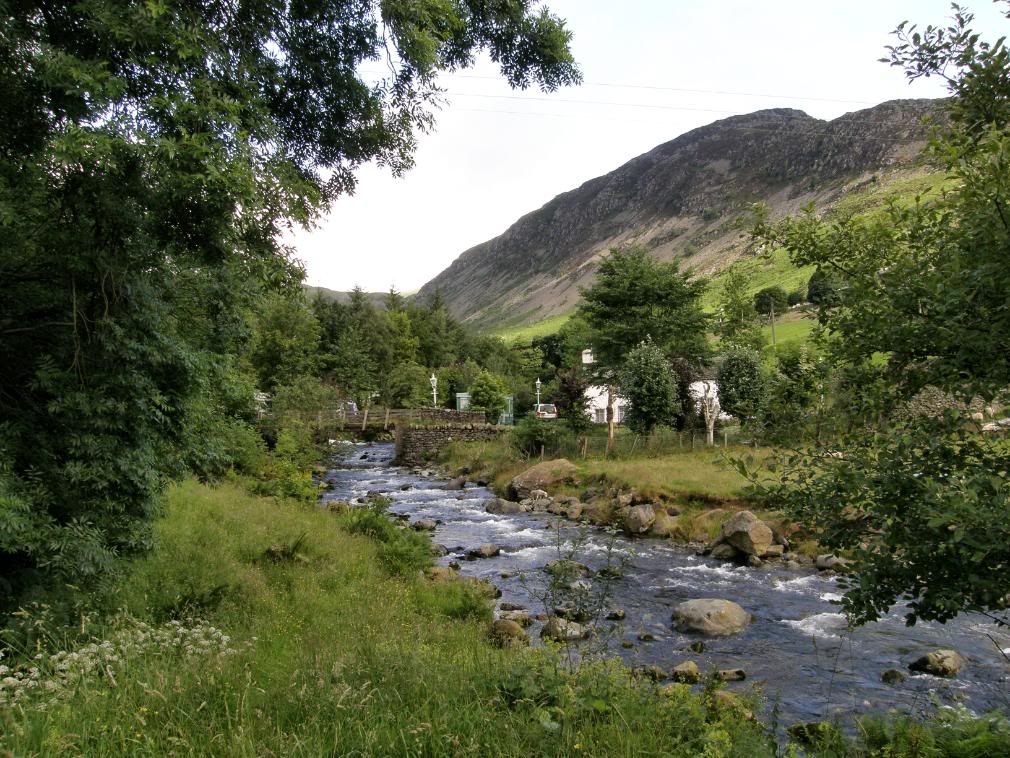
The path up besides Glenridding Beck through the village
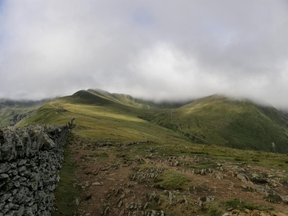
As we arrived in Glenridding the car park was fairly empty, which gave us hope for a clear run at Striding Edge come rain or shine. It would take some of the enjoyment away having to wait for a queue of people, and don’t expect to be able to push on past walkers who are taking their time along the ridge. It would be too dangerous for all concerned to get frustrated here, but in my humble opinion it is a safe route when the weather conditions are good. Once we were kitted up and had paid £6 for a full days parking, we crossed the beck and made our way up through the village, quiet at 7:30 in the morning. I thought it was quiet until we passed by the campsite – a not very attractive sight or site. The place was a tented village and there was a queue of campers at the toilet block, most of them looking like they needed a good nights sleep amongst other things - not my idea of fun. A little further uphill was a mobile buttie van, with the unmistakeable aroma of freshly cooked bacon floating on the early morning air, mmmmmmm. But we decided against a big bacon buttie just before the first ascent of the day, although I was mighty tempted. There are numerous paths up to Helvellyn from both the east and west sides. Wainwright nominates 7 routes from each side, with some easier than others, but whichever you choose it is a delightful area. So much so that you may end up forgetting any pain that you might have in your legs – Helvellyn is after all over 3000ft.
The stone path up to Birkhouse Moor – turn right at the col
We wound our way along turning left & right, Stuart checking the map, and eventually we started up a clear path towards Birkhouse Moor. The paths today were all in good condition, with no real scree walking, which makes life much easier on the legs. We kept stopping to take in the retrospective views over Ullswater and the surrounding fells – a theme for the day, and we didn’t break any records for speed. But oh what views, and an ever changing palette of colours as the sunshine came and went. Glenridding Dodd across the valley was looking particularly resplendent in freshly bloomed heather, a lovely contrast of purple and green. We didn’t see much wildlife today (apart from the campsite) and the mountain vegetation didn’t vary much from the sheep grazed grass. There were some large flocks of crows making much noise below Catsycam, and later on at the summit there was a large flock of seagulls floating on the wind coming in from the west.
A green and mauve Dodd
Looking across to St Sunday Crag from the wrong path
Both ends of Ullswater as we gained height
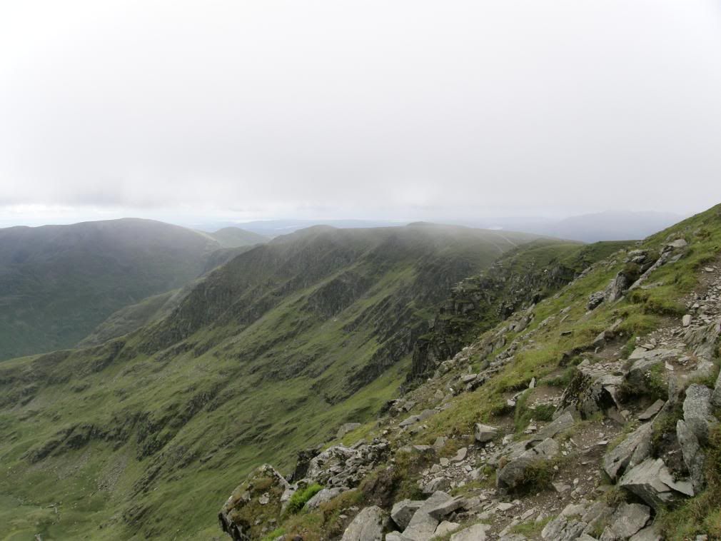
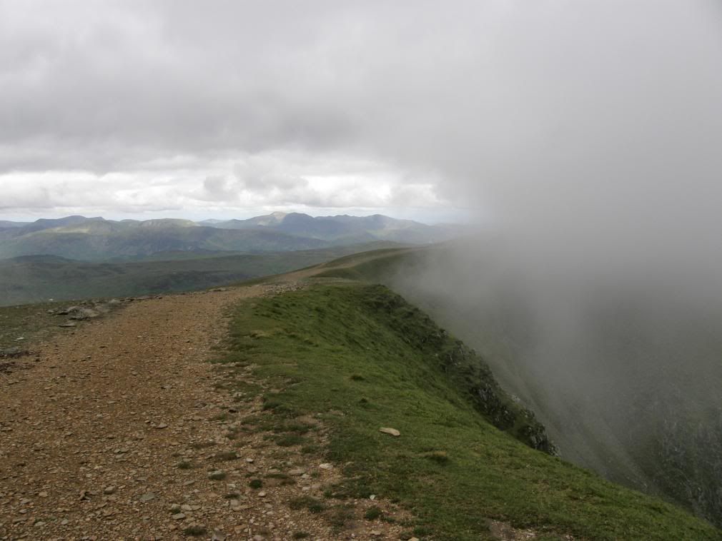
As we gained height up the hillside we veered off onto some zigzag paths which took us up to the first summit at Birkhouse Moor. We could have walked straight up the hillside but we were too busy chatting and looking at the views, but it was an easier route than the one that ran up alongside the wall. That wasn’t the last diversion of the day either! There were fine views of both ends of Ullswater, and here was probably the only place that you can see both ends of the lake. The surrounding fells of Birks and St Sunday Crag were prominent to our left side with the valleys falling away below us. The way ahead up to Striding Edge was clear, but unfortunately the cloud base continued to swirl over Helvellyn and down over the surrounding area.
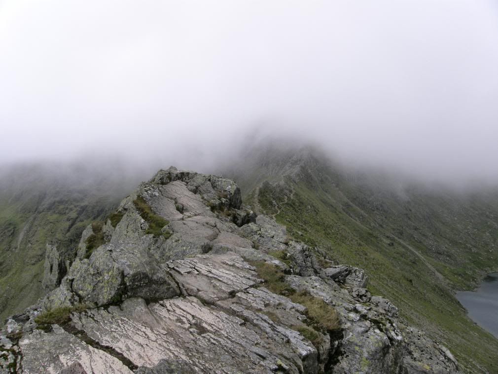
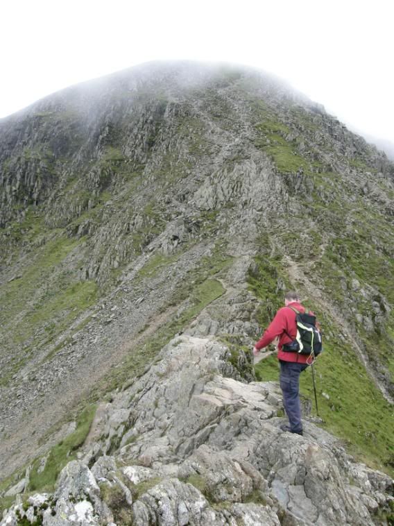
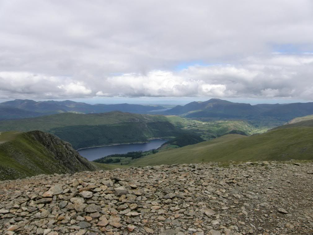
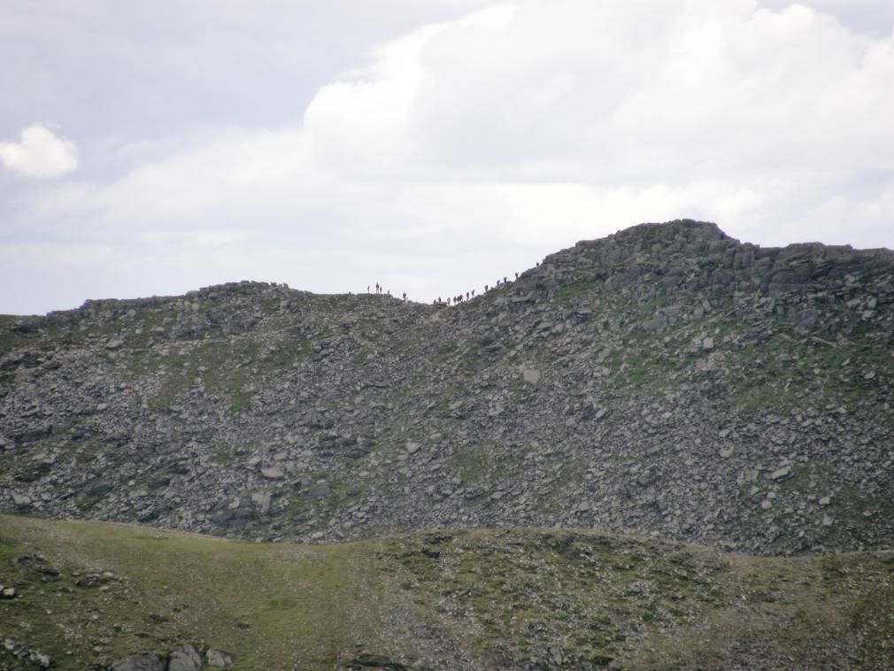
Catsycam and Striding Edge ahead in the clouds
By the wall looking towards Seat Sandal in the distance
The path is clear ahead with not a soul around
Looking back down Birkhouse Moor with Ullswater now far below
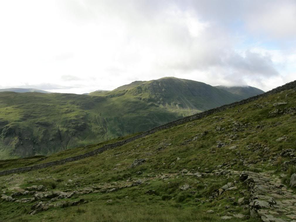
We passed by the hole in the wall, which is where the old path comes up across the slope – a gentler ascent from Glenridding which by-passes Birkhouse Moor, and onwards to the ridge. It was distinctly chillier here and we togged up in base layers and windproof layers. Anticipation built as we got closer to the start of the ridge, and for me it was good to be able to compare the exposure felt here with the Crib Goch walk I did back in April this year. The weather continued to hug the ridge, but with ‘Lucky’ being my middle name I assured Stuart that it would be good. The way along the ridge is clear enough as thousands of feet have worn, scratched and scuffed the surface over many years of walking.
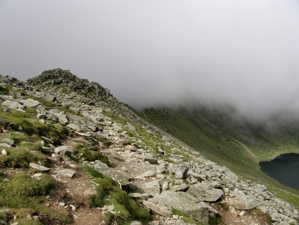
Up towards the start of Striding Edge with Red Tarn below
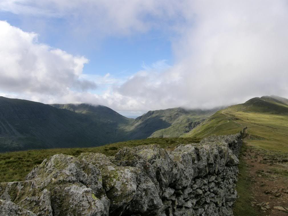
Looking down into Grisedale Beck – probably the longest drop off the ridge
All polished and clearly marked out for you….
There are clear crampon marks from the brave or foolhardy souls who walk this way in winter conditions, and you will see that there is no lichen or moss growth along the top of the ridge. In places the path has worn smooth, probably from people taking a breather to take in the great views from up here. We certainly sauntered along and enjoyed the experience, there was always only one route for us and that was along the top. For any of you with a fear of heights – what are you doing up here anyway? There is an alternative path that runs down below the ridge that will give you shelter from the worst of the elements, although it is quite narrow in places. But for me Striding Edge in benign weather conditions is nothing more than a careful walk with one or two short climbs and drops. But like all good ridge walks you need to concentrate and it is dangerous in inclement weather. The steepest drop is at the beginning of the ridge, but the path is wide here, with Nethermost Cove far below you to the left and Red Tarn to your right side, unless you are walking backwards. The shapely peak of Catsycam catches the eye all the way along this walk, as it is central to this round, added to the fact that Helvellyn still had its head in the clouds.
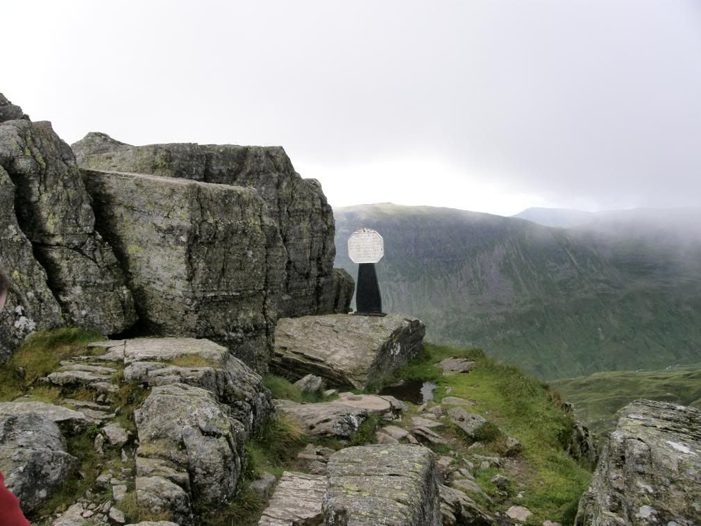
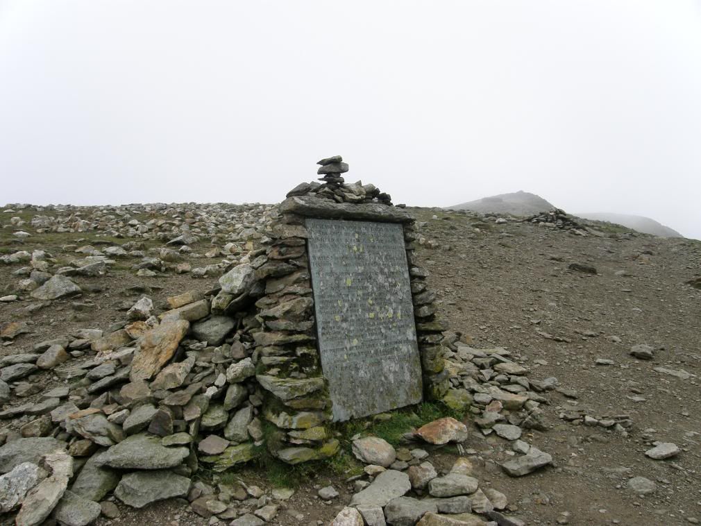
The Dixon memorial – patron Saint of electrical goods
The sunshine breaking through as we progressed
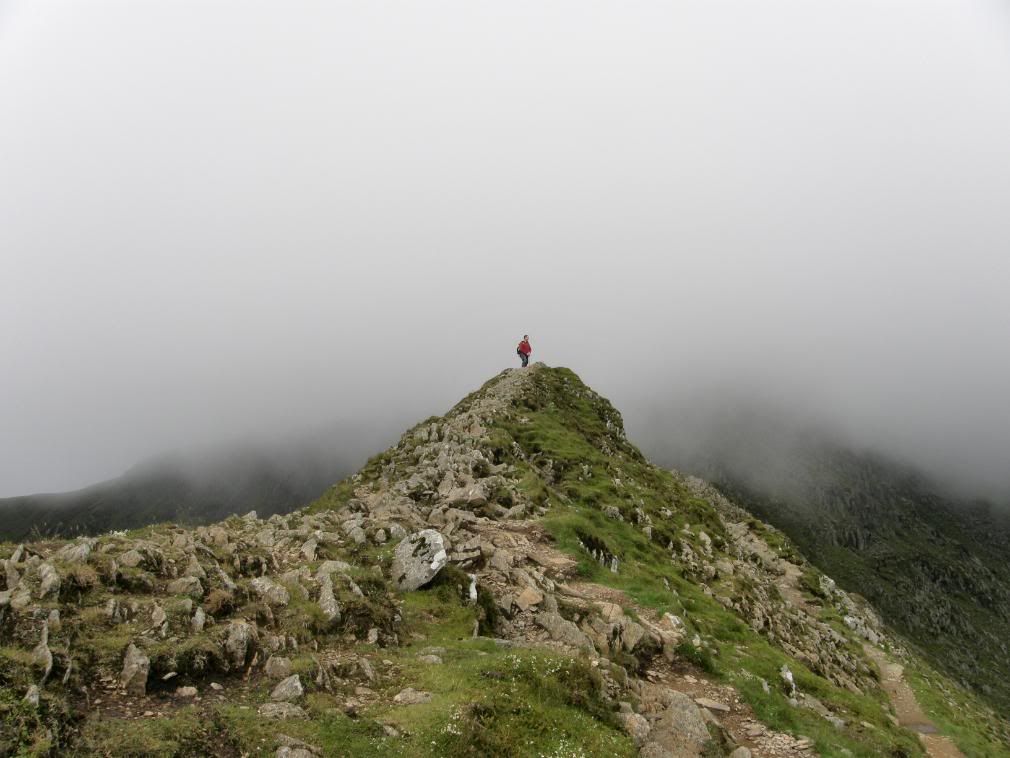
We passed by the Dixon memorial of 1858, a small steel post painted in black with a white top. It marks the spot where Mr Dixon was shouting ‘Tally-Ho’ moments before shouting ‘Tally-oops’ as he followed the local fox hounds on High Spying How. Once we were on the ridge the mist lifted higher up the slopes of Helvellyn, giving us a clear view ahead and to the adjacent fells and Ingleborough 30 odd miles in the distance – distinct with his flat top. At the end of the ridge before the climb up to the summit there is an awkward spot which drops down a small chimney of about 15ft. It has good foot and hand holds, but there is an easier route to drop off before here if you don’t fancy a little scramble. I think we both took it easy along here to savour the moment, made more enjoyable by being the only ones up here. Later in the day there was a long crocodile of people silhouetted against the skyline, and the only person we saw early on was a lone walker (not the Lone Walker) making his way up Catsycam.
Just go back down there and take a picture – OK just this once then
Stuart cleverly using only one leg
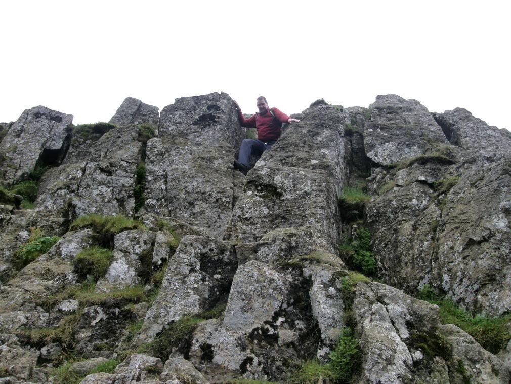
Just go down there and take a picture – Stuart negotiating the chimney drop
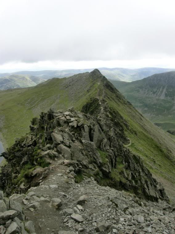
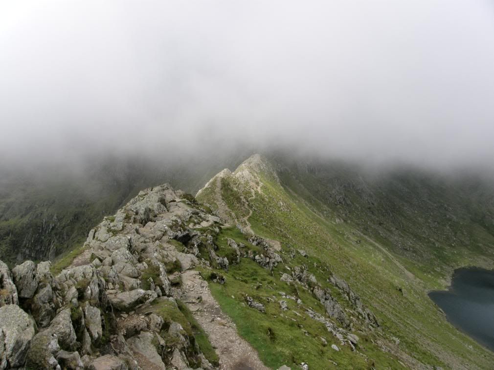
The entire ridge looking back to the start
A great panorama now that the mist had lifted
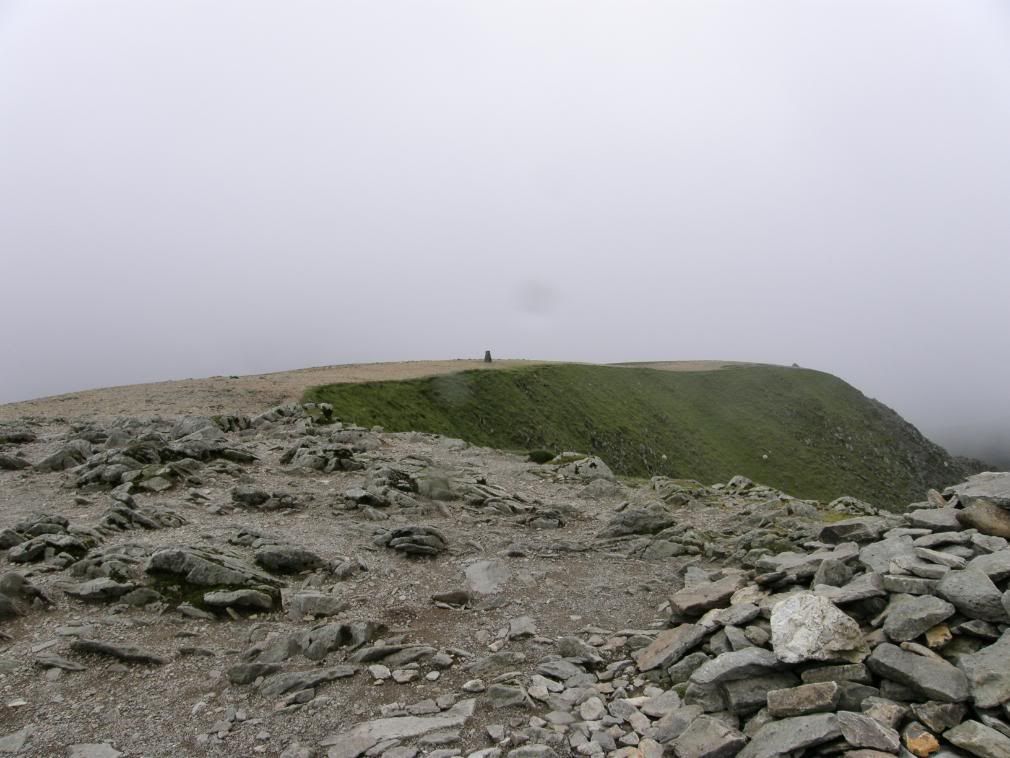
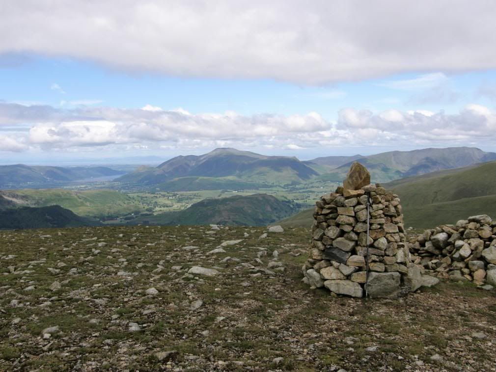
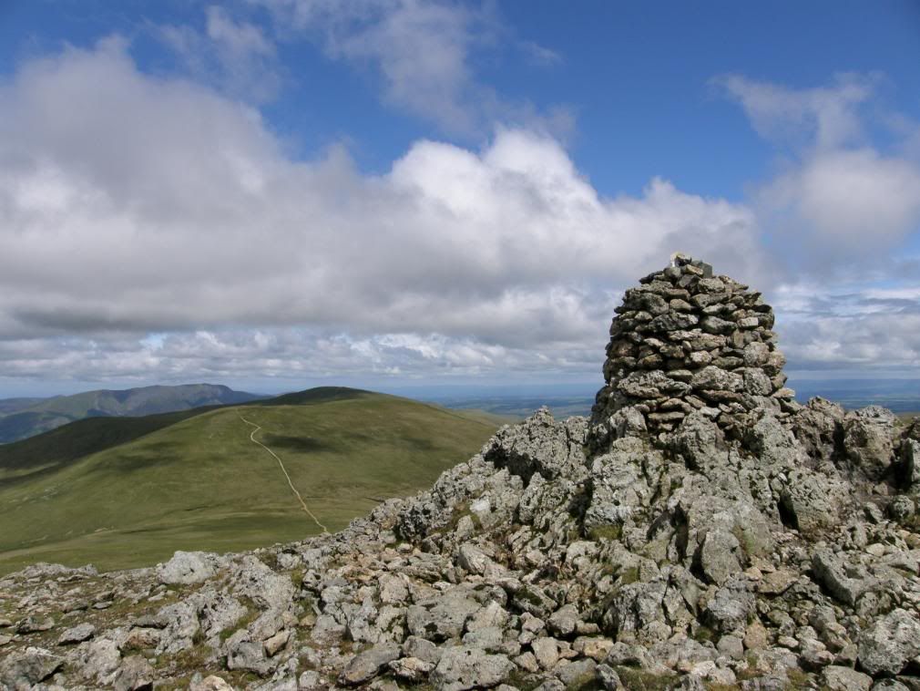
Once up on the summit we met two walkers who had come up the west side from Wythburn, a direct and very steep route – you would spend a lot of time looking at your feet on this route up. At the end of the ridge there is the remaining walk up to the summit on fairly sound stony ground. It isn’t too far up, and zigzags around a bit until you arrive at the second memorial on this walk. This one is a square stone slab dedicated to a man called Gough who died on this spot in 1890. His dog stayed faithfully beside his remains until someone found him some time later. It makes a good marker for descending down to Striding Edge if you are going that way. The summit area is stony but easy to walk along with the main paths almost like a metalled surface; a well graded gravel and stone is easy on the feet.
Looking across to Nethermost Pike from the ascent to Helvellyn
The Gough memorial – a good landmark
Looking over to the summit trig point from the summit cairn
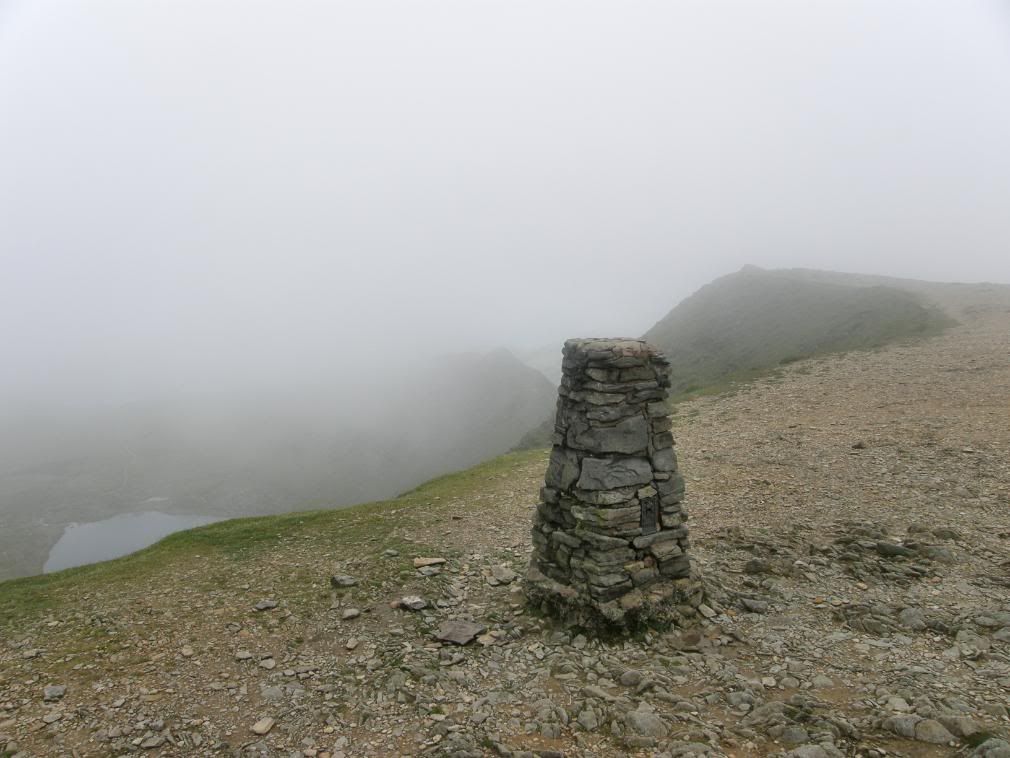
We made our way past the pathetic summit cairn and along to the cross shelter. Someone should build a cairn worthy of this mountain to sit and take in the breathtaking views from the top. Maybe Andy Goldsworthy and his chums should come up here. The third marker is just below the summit cross shelter and marks the spot where an aeroplane landed in 1926! The somewhat flat summit made the first British mountain-top landing of a plane possible, when John Leeming and Bert Hinkler successfully landed and took off again; no doubt the journey started with those famous words “I bet you a fiver you can’t land on top of a mountain”. With the wind chill and low cloud it felt closer to freezing – a reminder to be well equipped even in the middle of summer. Stupid me didn’t bring my gloves and paid the price with some severely numb fingers for a while, until Stuart kindly loaned me his gloves for a quick warm up. After a quick snack, it was on with the woolly hat and waterproofs as the low cloud became thicker. The summit cross area was clear of rubbish which made a refreshing change, and it doesn’t need an incinerator after all Mr W. Stuart had planned a short detour out along Swirral Edge to Catsycam and back again, but as we couldn’t even see Catsycam or the route down to Swirral Edge it seemed a bit pointless, so we abandoned the idea. As we wandered past the trig point I felt a bit disappointed that once more the best views were denied to me by the low cloud base.
Striding Edge now covered in low cloud
Let there be light – draw back that rain curtain
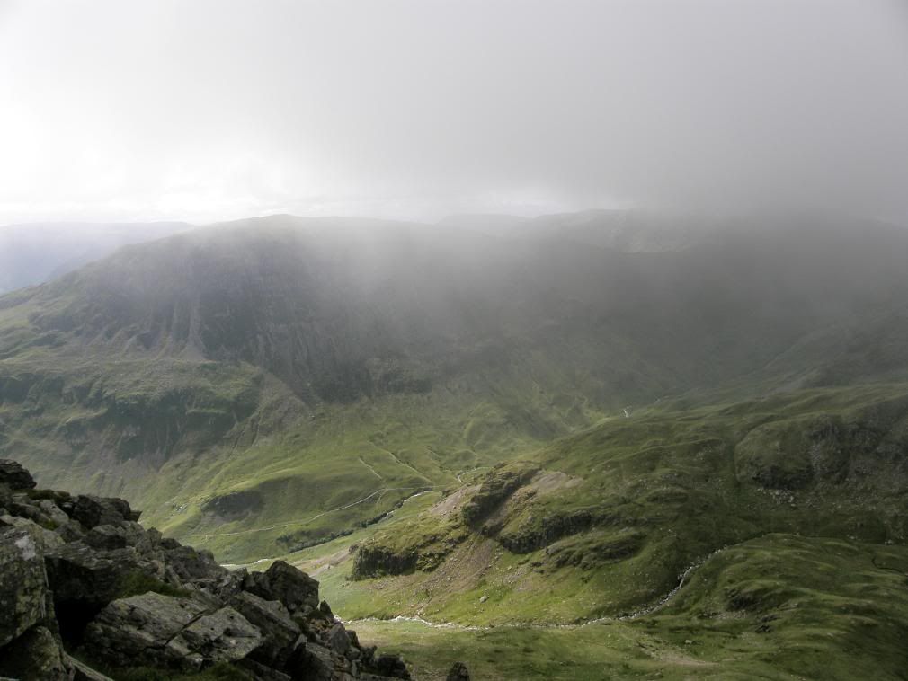
But if your born lucky and karma is on your side…a last shower passed and the clouds parted left and right as if someone had pulled apart a set of curtains. It was a wondrous moment and we couldn’t believe our luck as not only could we take in the views we could actually see for miles and miles – no heat haze to obscure anything. We spent quite a bit of time clicking away on the camera and then identifying the surrounding fells. A copy of Wainwright would have been useful as there are so many tops to see. I suppose the best views were to the north to the bulk of Skiddaw and onwards from there to the Solway Firth and Scotland beyond.
The Scafells and Bowfell – a flock of seagulls frolicking on the thermals
Vast views all around
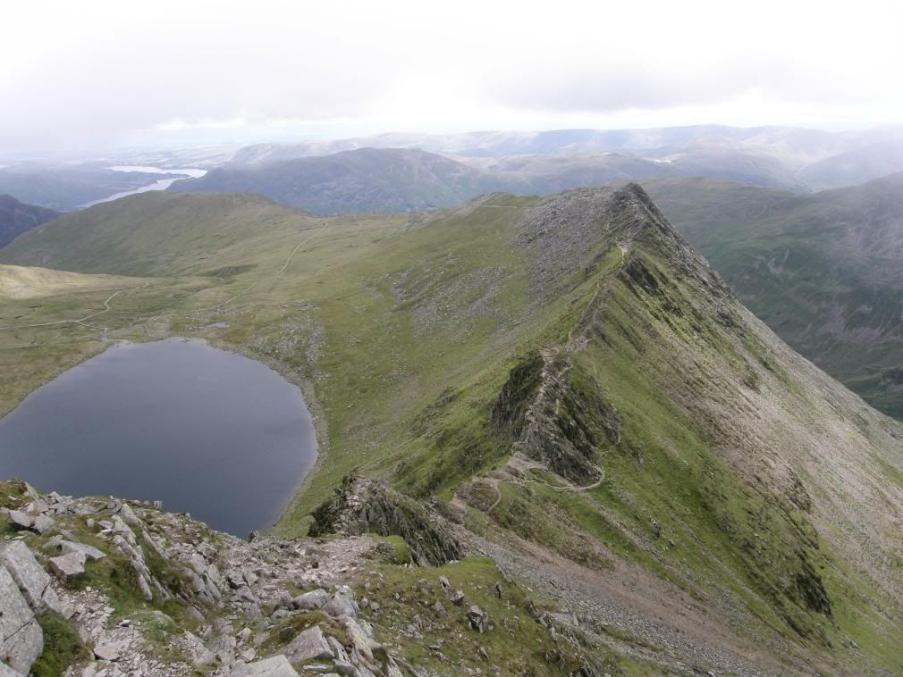
The shapely Catstye Cam with Ullswater in the distance
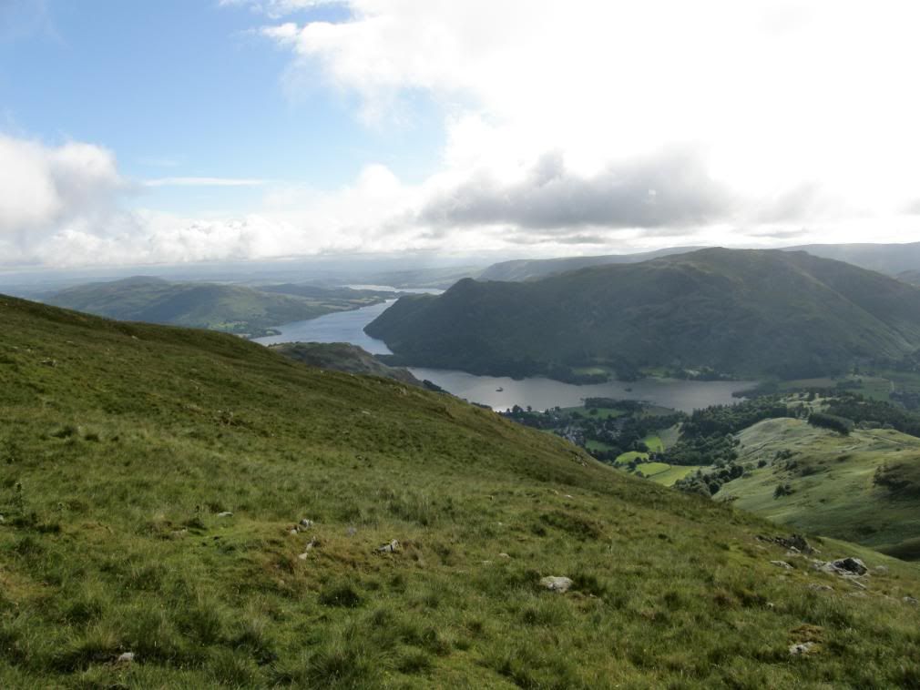
The view north over Thirlmere with Skiddaw beyond
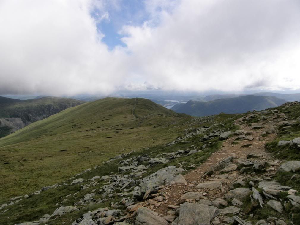
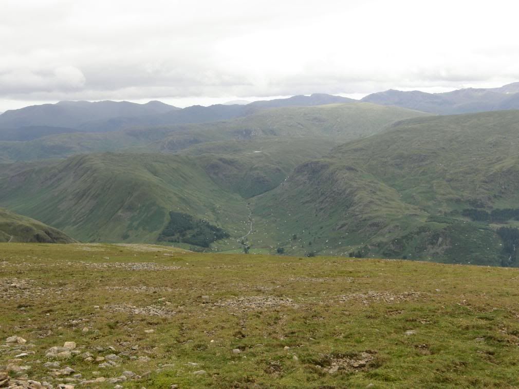
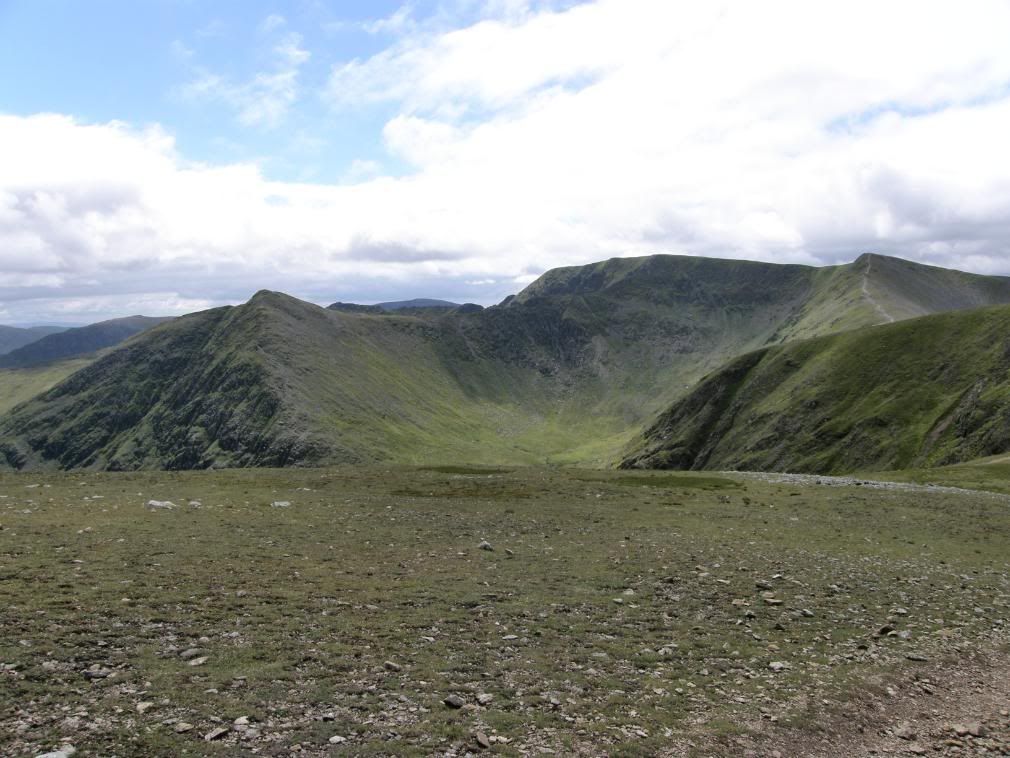
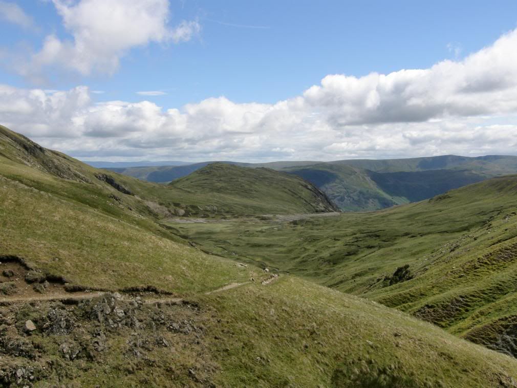
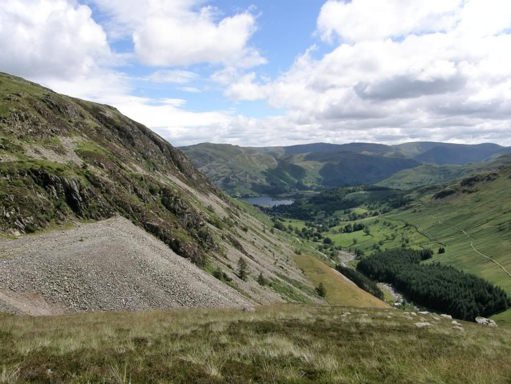
After dropping down to Lower Man we wandered on in a daze and took the wrong path, both too busy admiring the views to notice. But it wasn’t much of a diversion and we soon gained the route back up over Browncove Crag and onto the path to Whiteside. The walking along here was a delight, with great views over Keppel Cove, Catstye Cam and Glenridding beyond. The sun was out and we gently warmed as the scenery continued to unfold before us. There is an old dam in Kepple Cove which once contained an artificial tarn, although today the bed was looking very green & marshy. The water from the tarn was used in a hydroelectric scheme to drive electric winding gear at the Greenside Mine. Commissioned in 1891, this was the first such system in the country. It continued in use until the night of 29th October 1927 when the Kepple Cove dam burst during a heavy storm, leaving an 80 ft wide gap in the earthworks. The resulting wave passed down the valley and through Glenridding village, flooding buildings and causing extensive damage, but was much loved by the local surfer dude apparently.
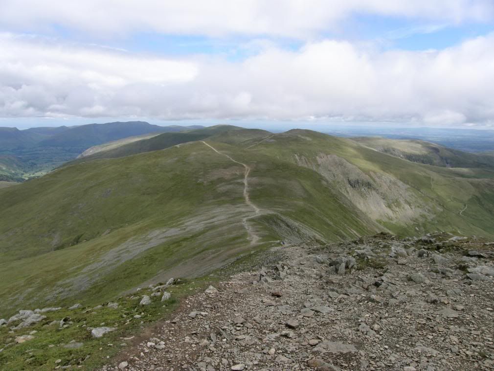
The path over to Whiteside Bank from Lower Man
Brown Cove below Catstye Cam, with the Keppel Cove dam below
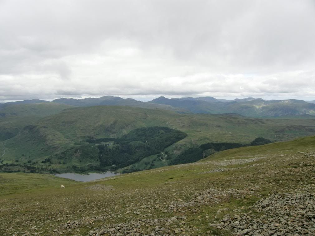
Now looking down you can see the big hole at the bottom left side of the dam, and numerous leets that channelled water to the tarn. The old man made dam in Brown Cove can just about be seen, with a puddle of a tarn behind it. There were more people around now, mostly on their way to the summit – many teenagers doing their Duke of Edinburgh awards, a few groups of mountain bikers – fast down but not so quick up, and some fell runners who didn’t hang about due to the temperature. We discussed sprinting to the top of Whiteside Bank to overtake one of them, but neither of us took up the challenge. Along the path up to Whiteside there were good views over to the ridges and a queue of people crossing Striding Edge. We were happy knowing that we had had the best of the day when we were over there.
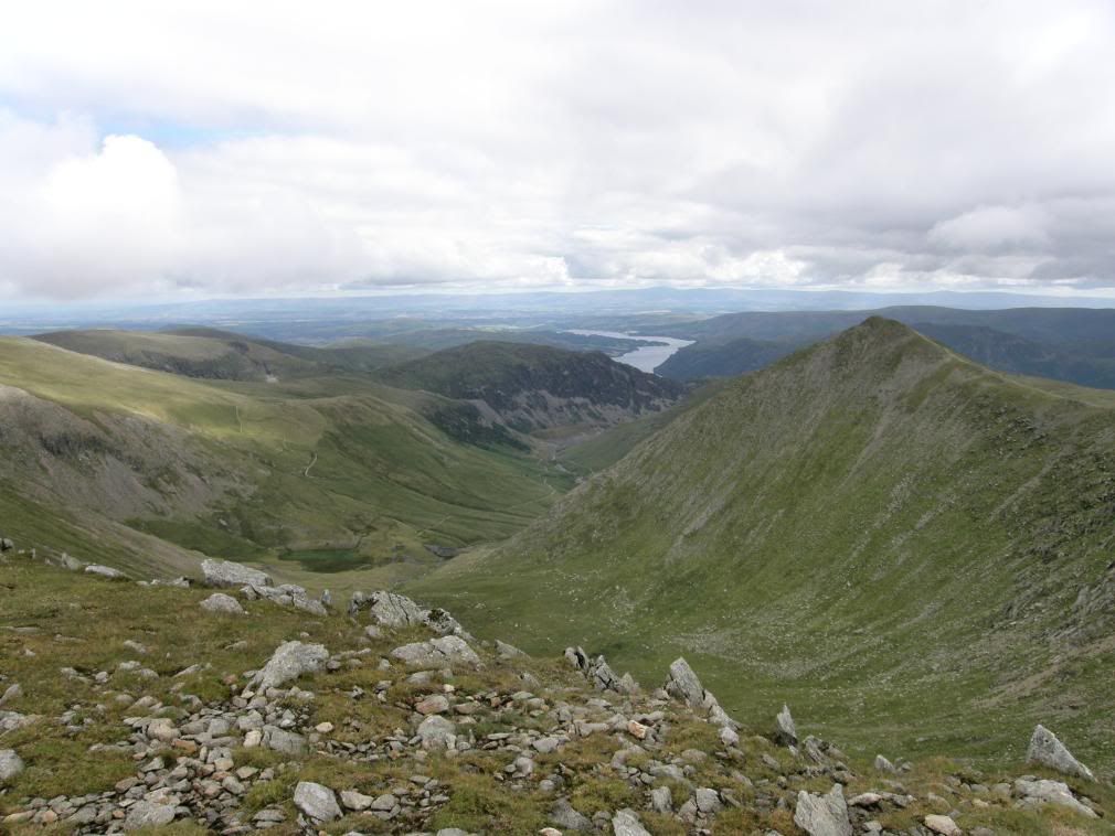
A look back to Helvellyn, Swirral Edge and Catstye Cam
Move along now…are we there yet…I need the toilet….
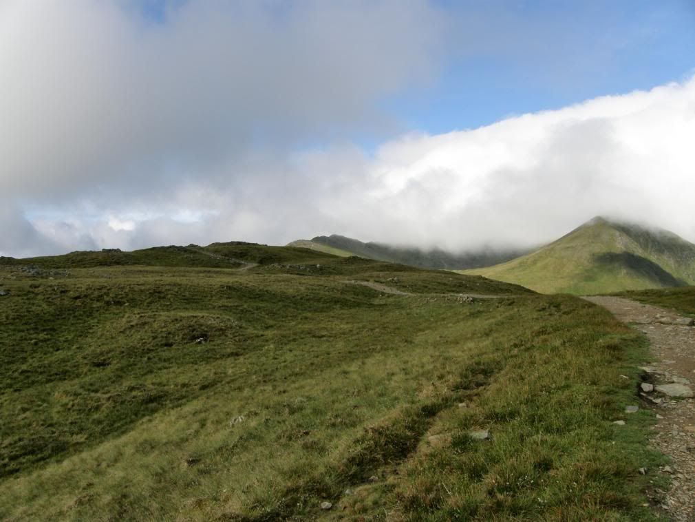
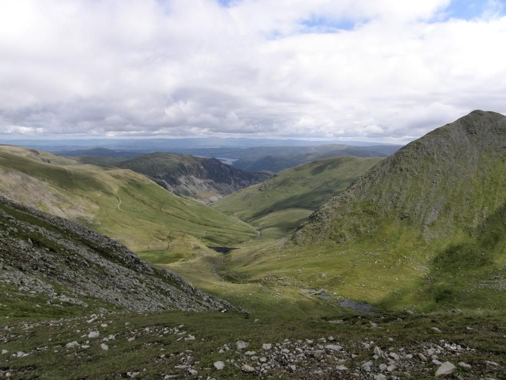
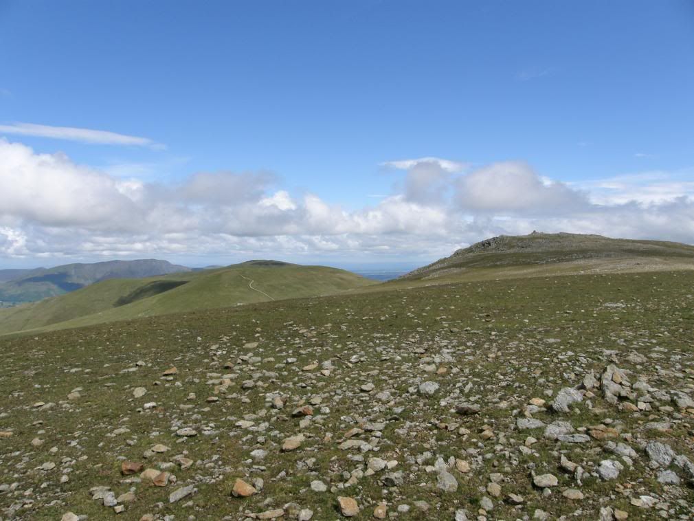
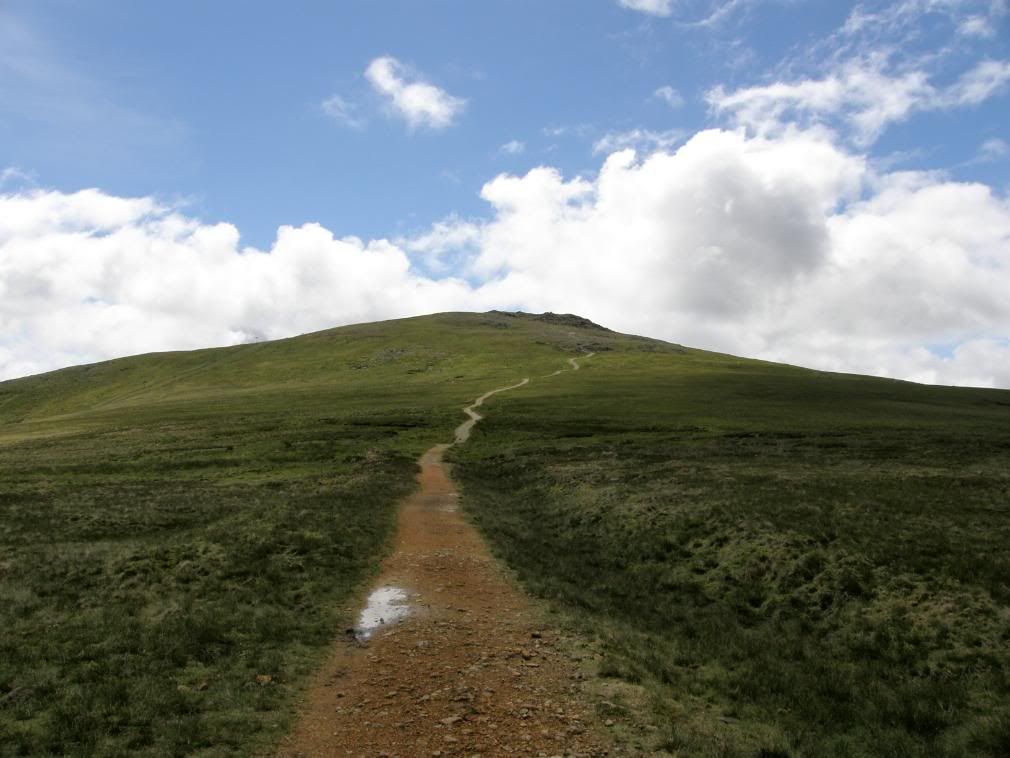
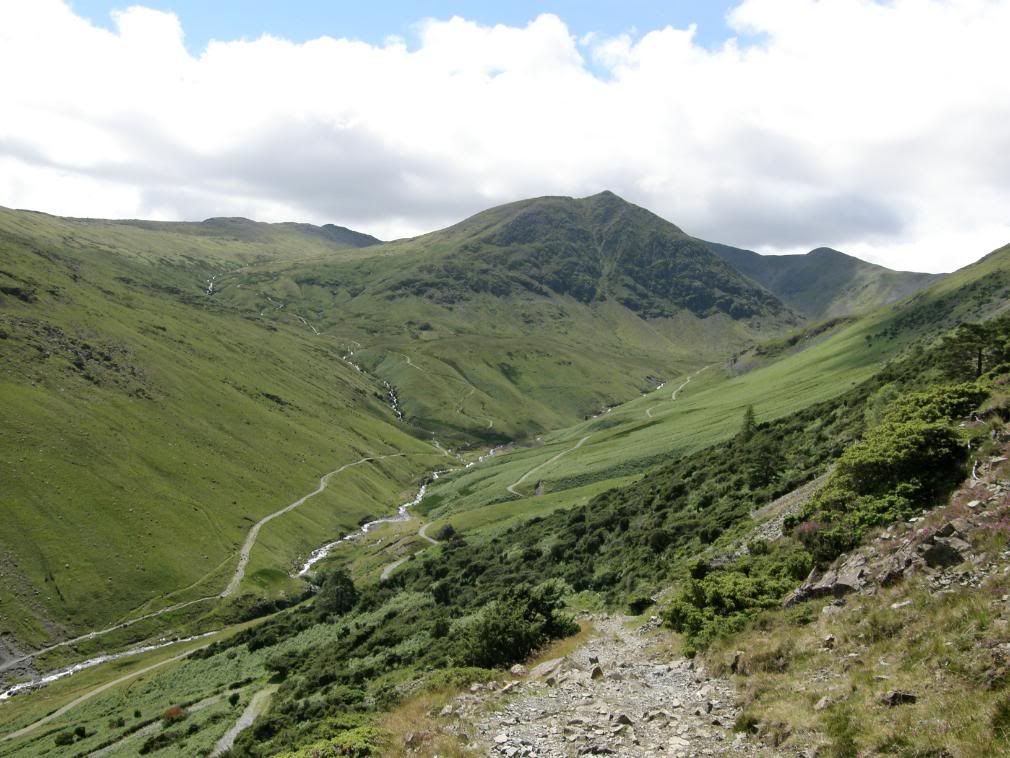
The path continued gently up towards Raise with several piles of stones masquerading as cairns marking the way. Once we reached the top of Raise it was now all downhill from here, but not before taking in the wonderful views once more, with Skiddaw and Blencathra prominent in our line of sight. Raise has a nice shapely cairn and from here the path dropped down to the col between two valleys, both marked on the map as Sticks Gill. So be careful if someone advises you to go down Sticks Gill, turn right for Glenridding.
The summit cairn on Whiteside Bank with Skiddaw in the background
Magnificent scenery – not so benign in winter time
Looking towards Raise – nice and easy walking
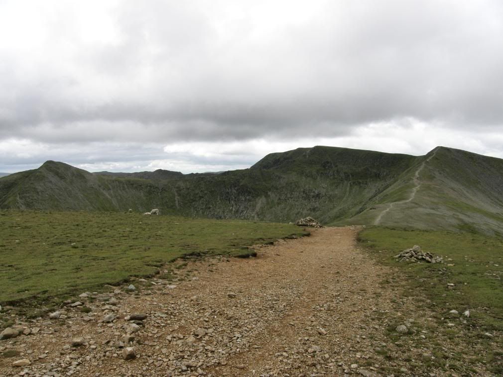
The summit cairn on Raise – the path drops down to the col from here
Looking back up to raise from the Sticks Pass cairn
We were getting progressively warmer as we dropped down into the valley as the cold wind died away. Up to our right we saw what appeared to be a ski run, probably the shortest run I have ever seen. Apparently it is run by the lake district ski club and they managed 10 days skiing last year - www.ldscsnowski.co.uk/, but having read a little I don’t think I’ll take up skiing now. Especially as there is a fairly steep gully that lies below the ski slope! The path followed the hillside gently down beside the beck, with a good flow of water on the actual path for much of the way. We peeled off the outer layers and I almost got the sunscreen out, but it wasn’t that hot.
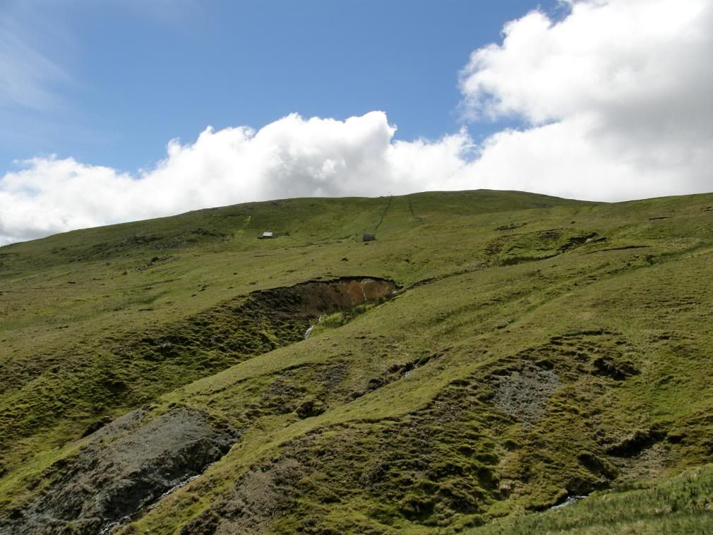
The ski lift, ski run and ski hut – don’t get too excited now.
Down in the valley the spoil heaps below Greenside come into view
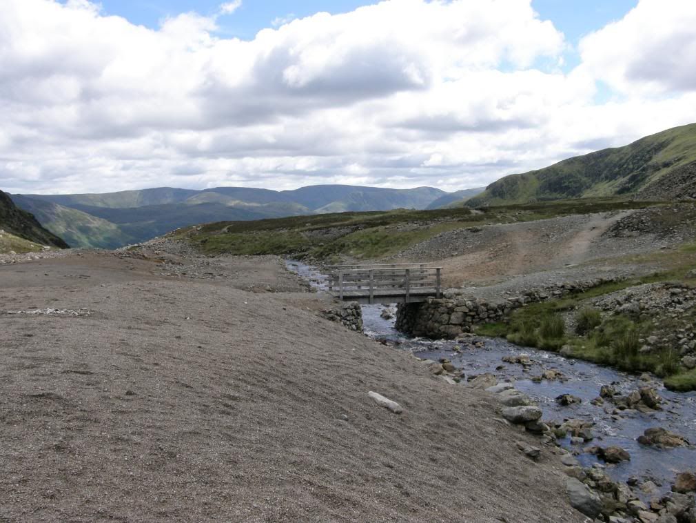
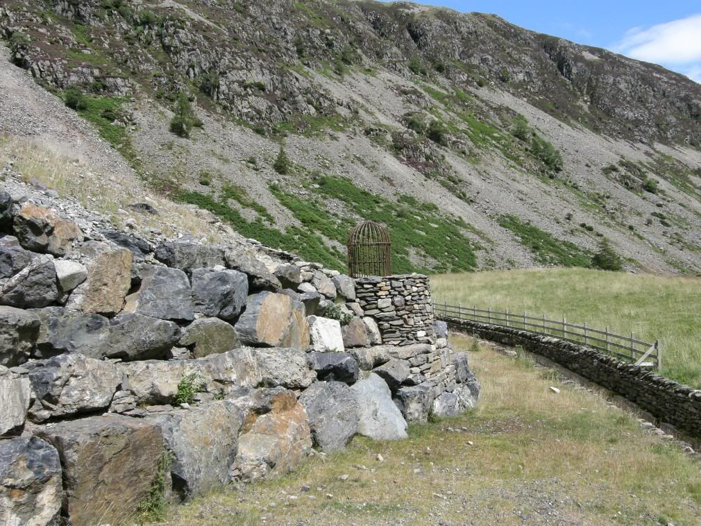
The old spoil heaps from the Greenside mines come into view and the valley floor is barren in places, a legacy of the old lead mining industry. There are not many remnants of the old mine buildings, and although I had a quick look, I couldn’t see much in the way of Galena (lead) lying around the place either. After crossing over a small wooden bridge the path continued down into the valley and Glenridding and the youth hostel. Looking at the spoil heaps here it is obvious that much remedial work has been carried out over the years to stabilise the slopes and obviously to prevent pollution to the groundwater from the old lead workings. There is a great wall of stone and a water channel to guide excess water away from the steeper slopes into the course of the beck. There was an interesting looking birdcage sitting above what looked like a well, but when we walked over for a look, it was just a fancy storm drain cover.
The old spoil tips and somewhere beneath here the old mine works
Getting closer to Glenridding – note the neat and tidy spoil heaps
Looking back up Glenridding Common to the still shapely Catstye Cam
I thought I saw a puddy cat a creeping up on me…..
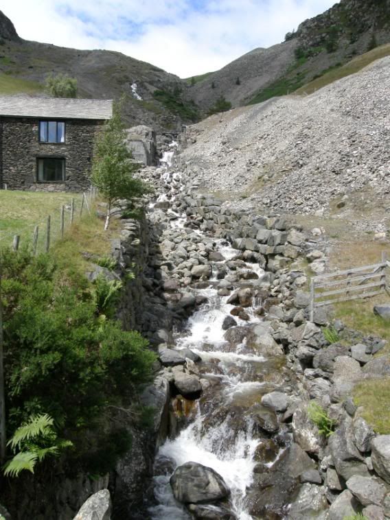
Glenridding Beck managed through the spoil heaps and old mine works
The old mine buildings have been converted for use by the YHA for school field trips etc. From here it was a short walk down through a few cottages and fields to the main car park at Glenridding which was now full to the brim. Here there is a fibre glass model of the hills of the surrounding area. I took a picture as I thought it would look good at the end of the story, but it ended up looking like someone’s false bottom or worse. It was a great short walk, taken at a leisurely stroll –it’s good to wander along enjoying the landscape. We both must be getting fitter as my legs felt like I could have gone around again, so walking is definitely good for you. Try it sometime, honestly it’s brilliant.


